
Peddars Way and Norfolk Coast Path National Trail
- Start: Knettishall Heath
- Grid Ref: TL 944807
- End: Cromer
- Grid Ref: TG 215420
- Distance: 145 km
- Walking Time: 7 days
- Counties Traversed: Norfolk, Suffolk
- Explorer™ Maps: 229, 236, 250, 251, 252
 As its title suggests, this National Trail links together two separate long distance paths, each with very different landscapes and history. Peddars Way was a Roman military road built about 60AD, following much of the course of the older prehistoric Icknield Way. Peddars Way, of course, is not a Roman name, but dates from the Middle Ages. As with most roman routes it appears as straight as an arrow on a map, heading NNW from Thetford to the coast at Holme-next-the-sea. On the ground, however, the Way does not give this impression, although route finding is straightforward. There is archaeological interest in the Roman road and the magnificent architecture of Norfolk's characteristic flint churches. Because it served a military function, that of getting Roman legionnaires from A to B as quickly as possible to suppress the activities of Queen Boudicea and the Iceni, Peddars Way does not link settlements. Consequently, it is nearly always quiet and in places almost remote.
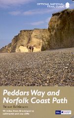
The Norfolk Coast Path, heading east from Holme-next-the-sea to Cromer, is a contrasting seashore environment of low cliffs, sweeping sandy beaches (amongst the finest in England), sand dunes, saltmarshes, mudflats and some internationally important bird sanctuaries. There is more habitation too, with many historic fishing villages along the coast and towns which can be busy during the holiday season. The initial overriding impression during the first part of the coastal section is of vast space, big skies and sand, sand, sand. The beach-walk along to Holkham Bay is especially enjoyable, although walking on sand can be hard going. For birdwatchers the route is an embarrassment of riches, from the rare stone curlews of Breckland to the marsh harriers sailing above the reed beds at the spectacular nature reserves at Titchwell and Cley.
The guidebook describes the route in eight day walk stages as follows:
Knettishall to Little Cressingham – 14.25 miles
Little Cressingham to Castle Acre – 11.75 miles
Castle Acre to Sedgeford – 14.25 miles
Sedgeford to Holme next the Sea – 6.25 miles
Holme next the Sea – Burnham Overy Staithe – 13.75 miles
Burnham Overy Staithe to Stiffkey – 10.5 miles
Stiffkey to Weybourne – 11.75 miles
Weybourne to Cromer – 8 miles
© Copyright 2000 - 2018 Walking Pages Ltd. and its associates. All rights reserved